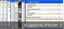
Access a set of tools to capture, analyze, and manage spatial or geographic data. Extract GIS data from HMS files and prepare GIS data for import into HEC-HMS. Visualize spatial information, perform spatial analysis, and delineate subbasins and streams.
Notre logithèque vous propose de télécharger gratuitement HEC-GeoHMS 10.8.0.10. Hydrologic Engineering Center est le développeur de ce logiciel gratuit. Notre antivirus a vérifié ce téléchargement, il est garanti 100% sécurisé.
Les versions fréquemment téléchargées de HEC-GeoHMS sont 10.5, 10.2 et 10.1. Le plus récent fichier d'installation disponible au téléchargement occupera 42.3 MB sur votre disque dur. Sur notre site, vous trouverez ce logiciel dans Photos et Graphismes et plus précisément Dessin 3D. Vous aurez besoin de la version 32-bit de Windows XP/XP Professional/Vista/7/8/10/11 pour faire fonctionner HEC-GeoHMS.
Du développeur:
HEC-GeoHMS is a free GIS extension that provides the user with a set of procedures, tools, and utilities for the preparation of GIS data for import into HEC-HMS and generation of GIS data from HMS output. The GIS extension has a user friendly interface.
Que diriez-vous d'essayer aussi des programmes en rapport avec HEC-GeoHMS ? Nous vous proposons PeaZip, Microsoft Visual Basic ou Wise Disk Cleaner.